Overview
Convex Geomatics Ltd. specializes in Construction Layout, Monitoring & Control for building, civil, and industrial projects across Alberta and Western Canada. We establish tight primary/secondary control, perform site calibrations with independent check shots, and maintain a single source of truth so field crews, designers, and contractors are working from the same coordinates and versions at all times.
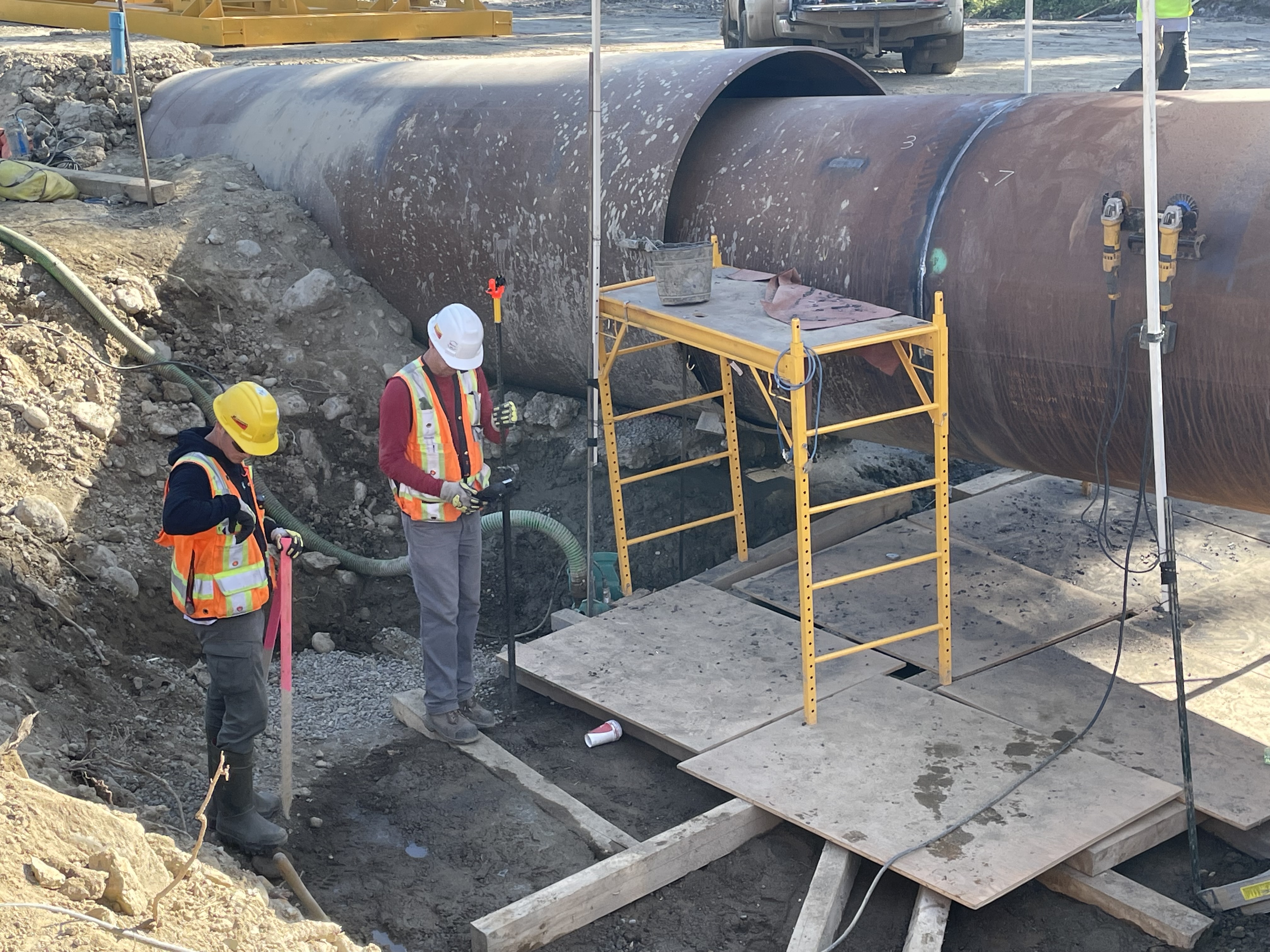
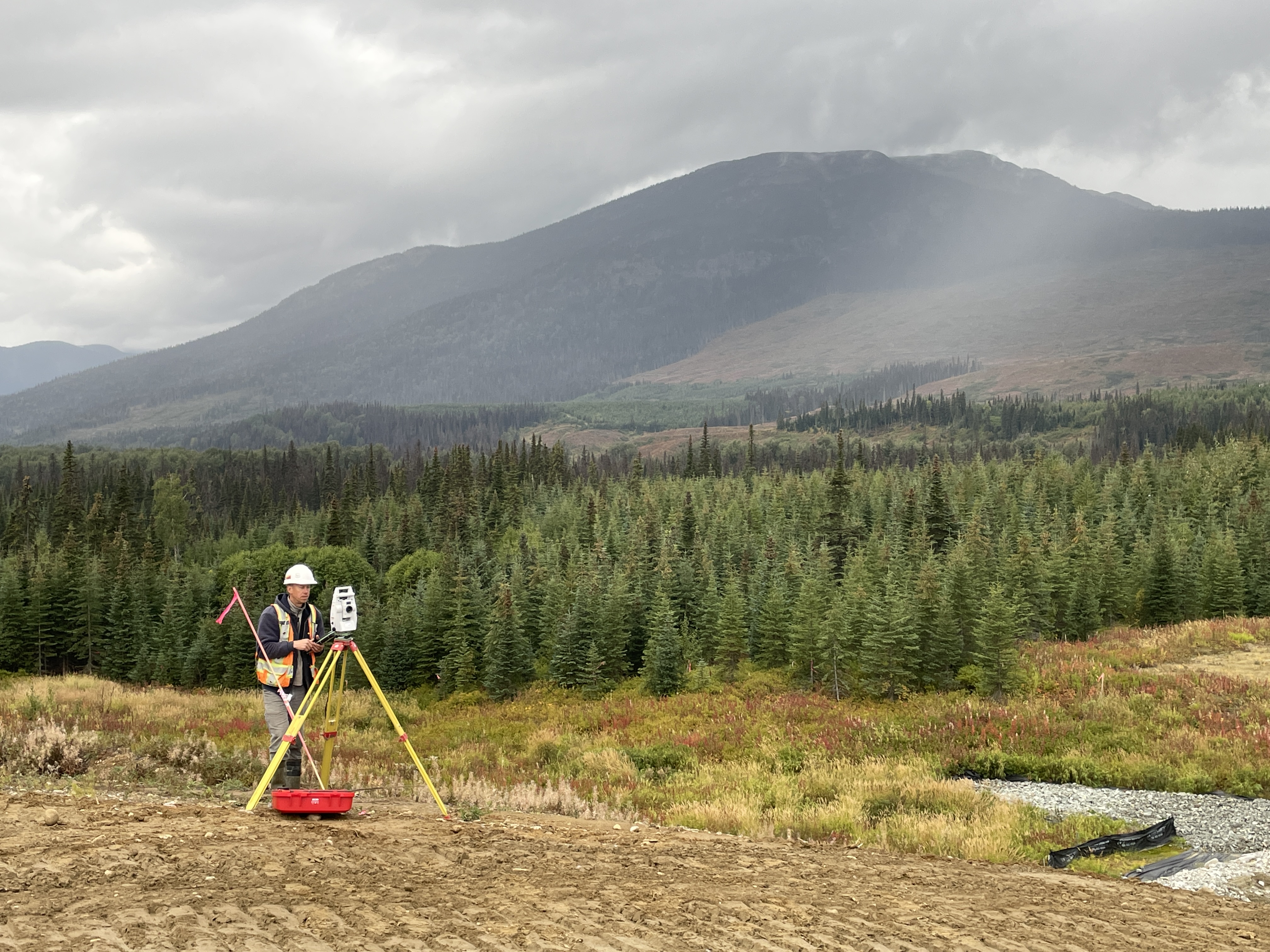
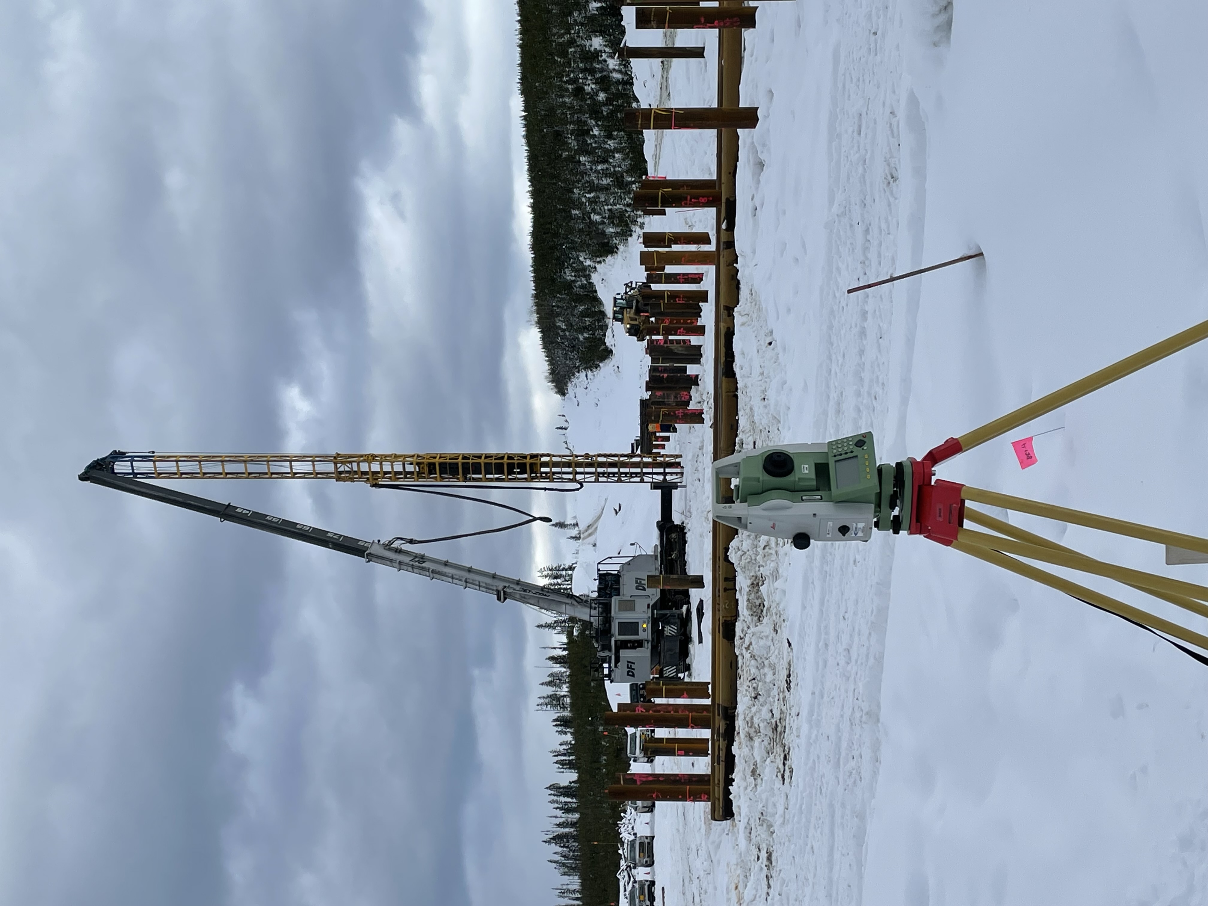
Construction Layout. From gridlines, foundations, anchor bolts, and embeds to utilities, curb & gutter, paving, and earthworks, our crews use GNSS RTK/PPK and robotic total stations to stake, verify, and document to your specified tolerances. We provide clear stake reports and hold-point sign-offs, plus rapid re-stakes as designs evolve to keep schedules on track.
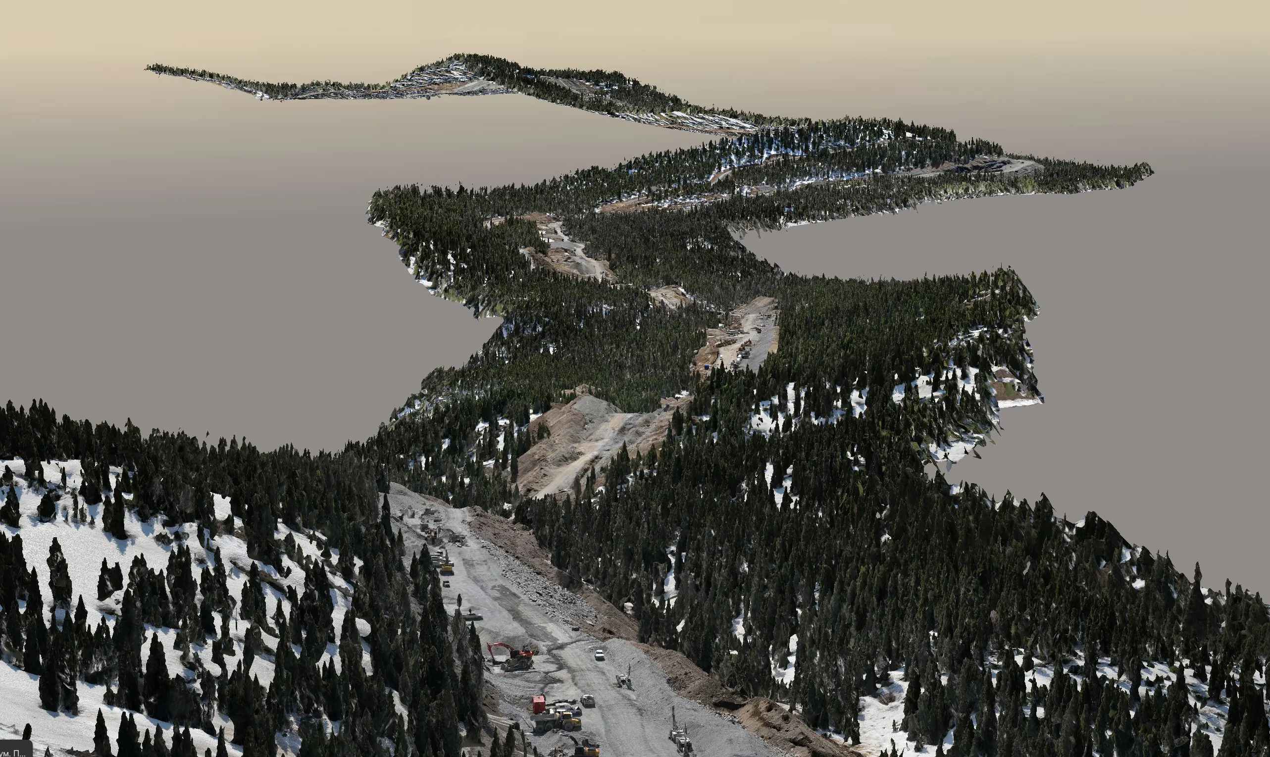
Monitoring & Verification. We deliver settlement and deformation monitoring using prisms/targets, reflectorless shots, and scan-to-model comparisons—producing trend charts, deviation heatmaps, and alert thresholds for proactive decision-making. Critical as-builts (inverts, slab elevations, rails, embedded plates) are checked against design with transparent QA/QC and independent checks.
Machine Control & Data Management. We build and maintain machine control models—surfaces, alignments, linework—and manage revisions/versions so operators always have current files. Controller-ready deliverables are provided for major platforms (e.g., Trimble, Topcon, Leica), along with CAD handover (Civil 3D/MicroStation) and a clear change log for full traceability.
*Subject to specification, site conditions, and control quality.
Monitoring Methods Compared
Choosing the right deformation monitoring approach for your structure.
| Capability | ATS Prisms | GNSS | Digital Leveling | TLS Scanning |
|---|---|---|---|---|
| Point precision | ±0.5–1.5 mm | few mm H / 5–10 mm V | ±1.5–3.0 mm/km | mm-cm |
| Continuous / automated | Yes | Yes | Campaign | Campaign |
| Best for | Structures, walls | Slopes, long baseline | Settlement | Volumetric / surface change |
More on monitoring & layout precision: High-Accuracy Surveying: Why Millimetres Matter.
See real deliverables
Open our Sample Data Portal — preview orthophotos, point clouds & 3D tiles in your browser.
Bridge Structural Monitoring Program
Automated total station prism network monitoring an active bridge during adjacent-structure construction — live dashboards and threshold alerts.
View all projectsDeliverables
 Field & Layout
- Stakeout of alignments, grids, bolt patterns, utilities, curb/gutter
- Cut/fill and elevation checks; hold points sign-off
- Digital stakeout reports with photos and coordinates
 Models & As-Built
- Machine control files (surfaces, lines, alignments)
- As-built drawings, point clouds, and comparison heatmaps
- Clash/clearance and tolerance check reports
 Formats
Layout Services
 Civil & Earthworks
- Roadways, grading, pads, and pipe networks
- Curbs/gutters, sidewalks, medians, lane lines
- Stockpile volumes & progress quantities
 Structural & Industrial
- Anchor bolts, column lines, baseplates
- Rack/silo plumbness and positional checks
- MEP sleeves and embeds verification
 Machine Control
- Surface models and alignments with QA
- Controller-ready files, site calibrations
- Ongoing updates and revision tracking
Structural, Settlement & Deformation Monitoring
Convex Geomatics delivers engineering-grade monitoring programs across Alberta and Western Canada — from automated total station (ATS) prism networks with real-time alerts to long-baseline GNSS campaigns, precise digital leveling for settlement, terrestrial laser scanning change detection, and integrated crack/tilt sensors. Programs are designed to your structure type, risk profile, and stakeholder reporting needs — with stamped documentation and documented threshold rules from baseline through commissioning and beyond.
Monitoring Services
 Structural Deformation Monitoring
- Buildings, bridges, retaining walls, industrial structures
- ATS networks observing prism arrays at scheduled epochs
- Reference points outside the influence zone for stable baselines
- Threshold rules per structure with escalation paths
Settlement Monitoring
- Foundations, embankments, tank pads, dams, reclaimed sites
- Precise digital leveling tied to deep benchmarks
- Long-term trend analysis with consolidation curves
- Fill placement and pre-load monitoring
Slope, Embankment & Pit-Wall
- GNSS arrays for long-baseline movement detection
- Robotic prism observations for active slopes
- TLS scanning for volumetric and surface change
- Landslide reactivation and pit-wall stability monitoring
 Tunnel & Excavation Monitoring
- Convergence arrays in tunnels and shafts
- Adjacent-structure protection during excavation
- Pre-construction baseline scans and crack mapping
- Integration with geotechnical instrumentation
Bridge & Overpass Monitoring
- Deck movement, vertical clearance, pier settlement
- Long-baseline GNSS and ATS observations
- Live-traffic and shutdown-window scheduling
- Acceptance & commissioning monitoring
 Crack, Tilt & Sensor Integration
- Crack-gauge and tiltmeter monitoring with survey baselines
- Pre-construction protection assessments and damage surveys
- Integration of third-party IoT and geotechnical sensors
- Unified dashboard view across all data streams
Scan-to-BIM Change Detection
- Periodic terrestrial laser scanning compared to baseline meshes
- Heatmap visualizations of surface deviation
- Volumetric change for stockpiles, basins, and slopes
- Signed reports tied to reference frames
 Reporting, Alerts & Outputs
- Threshold notifications via email/SMS/webhook
- Live time-series dashboards and trend plots
- Stamped reports with methods, stats, and acceptance
- Outputs: PDF CSV DWG/DXF LAS/LAZ JSON/API
Need a monitoring program designed and deployed?
We will scope the network, set thresholds, and stand up the dashboard.
Monitoring Technology
 Automated Total Stations (ATS)
- Robotic instruments locked to prism arrays
- Scheduled epochs with on-board QA and re-observation
- Independent reference frames outside the influence zone
Continuous GNSS
- Multi-frequency, multi-constellation receivers
- PPK / network solutions with rigorous adjustment
- Long-baseline trend analysis for slow-moving features
Precise Digital Leveling
- Network design tied to deep benchmarks
- First/second-order procedures and procedures audits
- Adjustment with documented residuals and RMSE
Terrestrial Laser Scanning (TLS)
- Baseline scans then periodic re-scans
- Cloud-to-cloud and cloud-to-mesh deviation analysis
- Heatmaps and volumetric change reports
 Sensor Integration
- Crack gauges, tiltmeters, MEMS arrays, piezometers
- Data fusion with survey observations on one dashboard
- Unified reporting across geotechnical and survey data
Software & Reporting
Industries & Structures We Monitor
Civil & Transportation
Bridges, overpasses, retaining walls, embankments, MSE walls, abutments, and approach slabs — for owners, contractors, and consulting engineers.
Energy & Industrial
Refineries, plants, tank farms, towers, racks, and reclaimed sites — settlement, tilt, and structural monitoring with shutdown-window coordination.
Mining & Aggregates
Pit-wall stability, tailings dam crests, haul-road embankments, and reclamation areas — long-term GNSS plus prism observations.
Buildings & High-Rise
Adjacent-structure protection during excavation, vertical movement of high-rise cores, and post-construction settlement.
Water & Environmental
Dam crests, spillways, slope stability around reservoirs, and basin/embankment volumetric change.
Municipal & Asset Owners
Long-term programs for bridges, retaining systems, and critical infrastructure with annual or post-event re-observations.
Workflow
- Pre-construction — project control, site calibration, model review
- Stakeout — robotic TS/GNSS stake to design; hold points sign-off
- As-built — scan/measure and compare to model/tolerances
- Machine control — prepare/update surfaces and alignments
- Monitoring — establish baselines and observe at set frequency
- QA/QC — checks, residuals, and documented acceptance
- Handover — final drawings, reports, and data packages
Technology
Instruments
- Robotic total stations and digital levels
- GNSS RTK/PPK with network/base support
- Handheld SLAM LiDAR
CAD/BIM & Field Ecosystem
File Support
Control & QA
Control
- Primary/secondary control with redundancy
- Site calibration and validation checks
- Benchmark maintenance and protection
 QA/QC
QA/QC
- Independent check shots and closure
- Residuals, RMSE (H/V), tolerance summaries
- Full sign-off documentation
Handover
- As-built CAD, PDFs, CSVs, and point clouds
- Machine control updates and archive
FAQ
Need precise layout or continuous monitoring?
We’ll align tolerances, formats, and QA to your construction specs.