
Overview
Convex Geomatics Ltd. turns raw LiDAR into design-ready maps and models that drop straight into your CAD/GIS workflows. Whether the data comes from a helicopter, airplane, UAV, mobile mapper, or terrestrial scanner, we organize it, enrich it, and deliver exactly what your team needs to design, build, and sign off with confidence. For context on what separates a good LiDAR provider from a poor one, see our Not All LiDAR Services Are Equal breakdown.
Faster than traditional survey. LiDAR lets us cover large areas in hours, not weeks — capturing dense 3D detail while keeping field time and traffic disruption to a minimum. Our processing pipelines compress schedule risk and help you move decisions forward sooner.
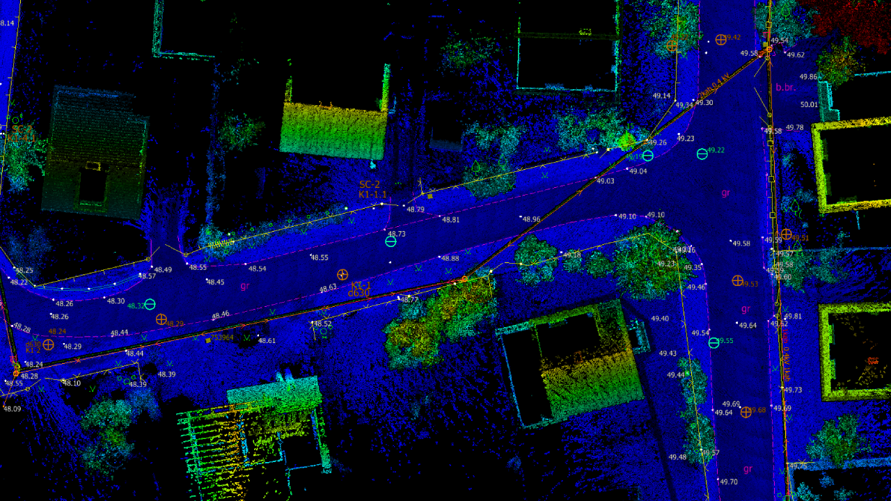
AI-assisted feature extraction. Using computer-vision and machine-learning tools — paired with experienced editors — we can quickly extract the features that matter: road edges and centerlines, curbs and gutters, breaklines, building footprints and rooflines, powerlines and poles, fences and walls, drainage features, shorelines, and vegetation metrics such as height and canopy extents (where visible in the data). The result is clean vector data that's easy to review and ready to use.
Any source, any format. We accept virtually all common LiDAR and imagery formats (LAS/LAZ and vendor exports), including colorized point clouds and intensity. If you only have legacy tiles or mixed coordinate systems, we'll normalize datums and projections so everything lines up.
Clean deliverables for design. Expect clearly documented packages in DWG/DXF, SHP/GDB, GeoTIFF, LandXML, and LAS/LAZ — with layer names, symbology, and metadata tailored to your standards for smooth use in Civil 3D, MicroStation, and ArcGIS.
Quality you can defend. Every project includes an audit-ready QA/QC summary with coverage checks and accuracy statements, plus a concise README so anyone on your team can understand methods, units, and coordinate reference details.
Tell us what you need mapped. Share the features, accuracy, and timelines you care about — we'll recommend the quickest, most cost-effective LiDAR processing plan and show sample outputs to make approval easy.
- Inputs supported: Airborne, UAV, mobile & terrestrial LiDAR; LAS/LAZ and most vendor formats; RGB colorization & intensity.
- Core processing: GNSS/IMU PPK/PPP, boresight calibration, strip alignment, tile schema, vertical datum & projection management.
- Classification: Ground, vegetation (low/med/high), buildings, bridges, water & more per ASPRS specs.
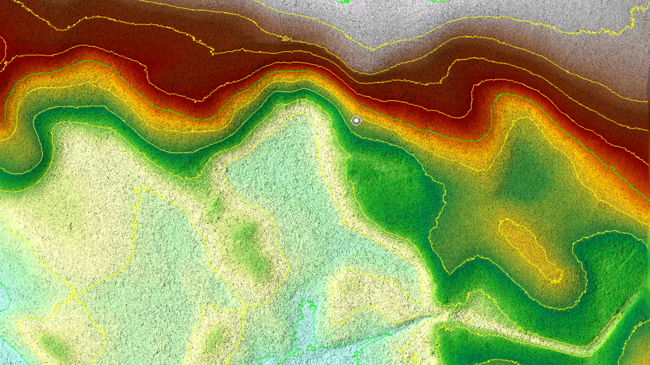
- Surfaces & hydrology: DTM/DSM, breaklines, hydro-flattening, sink removal, contouring (0.25–1.0 m).
- Accuracy: Typical deliverables achieve ±2–5 cm horizontal, ±3–6 cm vertical (data quality and control dependent).
- QA/QC: Checkpoints, residuals, RMSE/LE90/CE90, completeness; change logs & metadata (ISO 19115).
*Typical timeline — actual schedule depends on project size, input quality, and scope; confirmed at kickoff.
Manual vs Automated vs Hybrid Classification
How LiDAR processing approaches compare on quality, throughput, and cost.
| Capability | Manual | Automated | Hybrid (ours) |
|---|---|---|---|
| Bare-earth accuracy | Excellent | Variable | Excellent |
| Throughput (km/day) | Low | Very high | High |
| Edge-case handling (forest, structures) | Excellent | Limited | Excellent |
| Repeatability | Variable | Excellent | Excellent |
| Cost per km | High | Low | Mid |
| Best fit for | Critical sites | Open terrain | Most engineering work |
For more on what makes processing engineering-grade, read Not All LiDAR Services Are Equal.
See real deliverables
Open our Sample Data Portal — preview orthophotos, point clouds & 3D tiles in your browser.
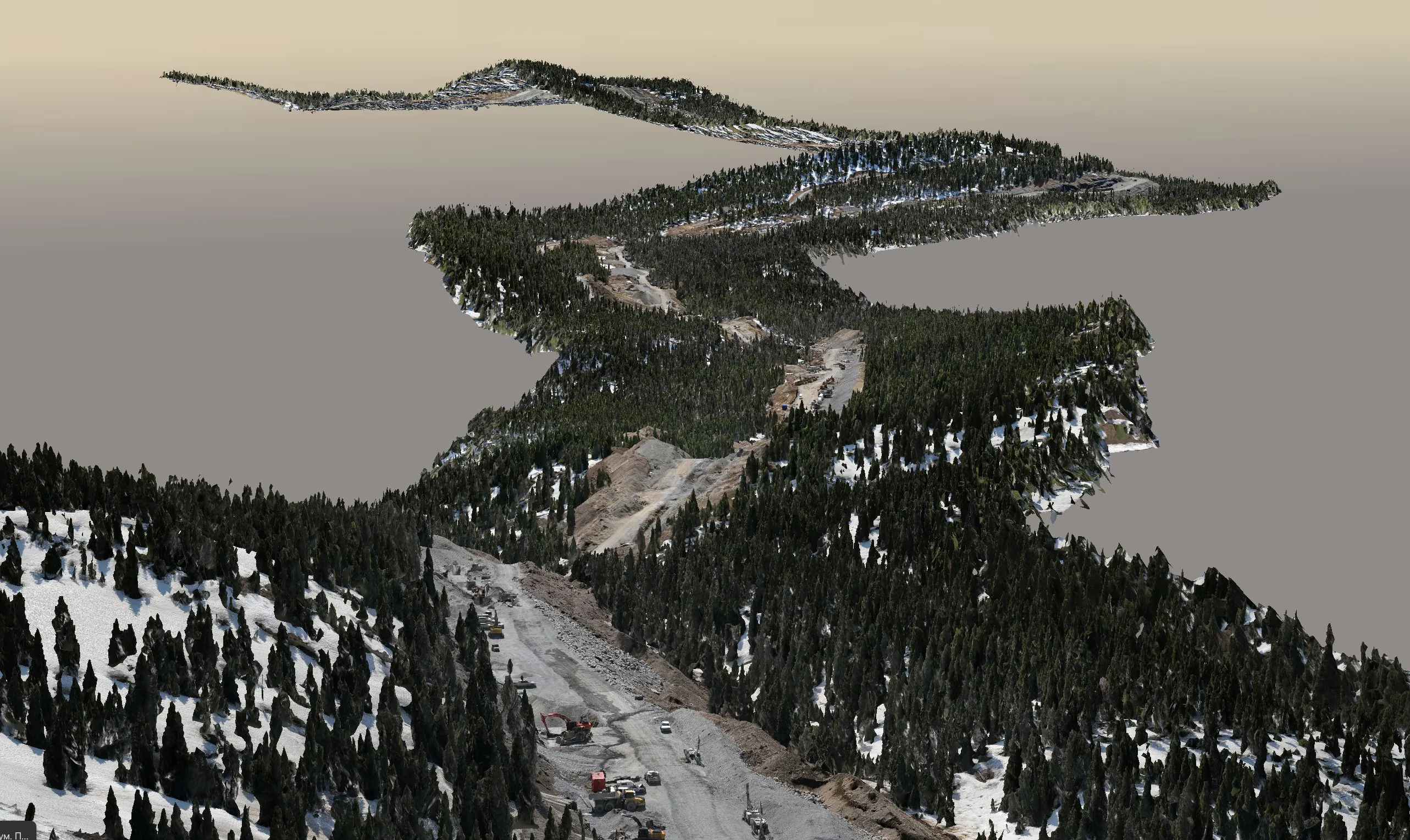
Pipeline Corridor Data Processing — 200 km
Classified LiDAR point cloud, hydro-aware DTM, and CAD-ready breaklines for a 200 km pipeline corridor in Alberta.
View all projectsDeliverables
 Core Outputs
- Classified point cloud (LAS/LAZ)
- Digital Terrain/Surface Models (DTM/DSM)
- Contours
- Orthophotos
 Engineering Products
- Breaklines & hydro-flattened surfaces
- Ground clearing & change detection
- Cross-sections & profiles
- Vectorized features
 Formats
Workflow
- Data intake & QC (coverage, metadata, control)
- Trajectory processing (PPK/IMU) & boresight
- Strip adjustment & noise filtering
- Classification to ASPRS standards
- Surface modeling, breaklines & contours
- Feature extraction & vectorization (roads/curbs, utilities, transmission lines, buildings, hydrology)
- QA/QC report & deliverable packaging