
Overview
Convex Geomatics Ltd. delivers fast, safe mobile mapping by combining vehicle-mounted LiDAR, 360° panoramic imaging, backpack-mounted LiDAR and handheld SLAM LiDAR. We capture dense, georeferenced 3D at highway speeds and continue seamlessly into GPS-denied interiors such as tunnels, plants, and parkades — producing datasets that drop cleanly into engineering design, asset inventories, and digital twin programs. For deeper context on digital twin workflows, see our Digital Twins and Gaussian Splats article.
Speed & safety first. Working from the roadway means fewer lane closures and less field exposure. Our vehicles cover long corridors efficiently while SLAM crews handle tight or obstructed spaces, so your network is mapped with minimal disruption.
Defensible accuracy. GNSS/IMU trajectories, survey control integration, and SLAM optimization deliver centimetre-level results you can trust. Continuous checks and transparent QA/QC make the data approval-ready for owners and consultants alike.
Rich, review-ready content. We provide full-coverage point clouds and colorized 3D with synchronized 360° imagery for rapid feature confirmation. Curb lines, lane markings, signage, utilities, bridges, and clearances are captured in one pass, giving teams a shared visual record for decisions and design. Many clients pair this with a high-resolution 3D mesh model for visual review.
Fusion when it matters. Need rooftops, bridge decks, or cliff faces? We can merge UAV and terrestrial scans with mobile LiDAR to fill occlusions and complete the vertical picture — aligned to your project control, datum, and CAD/GIS standards.
Tell us what you need measured and to what tolerance. We'll recommend the most efficient mix of vehicle, backpack, SLAM, and UAV to meet your schedule and budget, and deliver clean, documented data that's ready for design and asset management.
Mobile LiDAR vs Aerial vs Static
Choosing the right LiDAR capture platform for corridors, urban, or facility scans.
| Capability | Mobile LiDAR | Aerial LiDAR | Static TLS |
|---|---|---|---|
| Roadway / corridor speed | Very high | Very high | Low |
| Vertical accuracy | ±2–3 cm | ±3–6 cm | ±3–10 mm |
| Indoor / tunnel / interior | Yes (with SLAM) | No | Yes |
| Bare-earth under canopy | Limited | Excellent | No |
| Best fit for | Roads, rail, urban | Corridors, terrain | Detail / GNSS-denied |
More: Not All LiDAR Services Are Equal · LiDAR vs Photogrammetry.
See real deliverables
Open our Sample Data Portal — preview orthophotos, point clouds & 3D tiles in your browser.
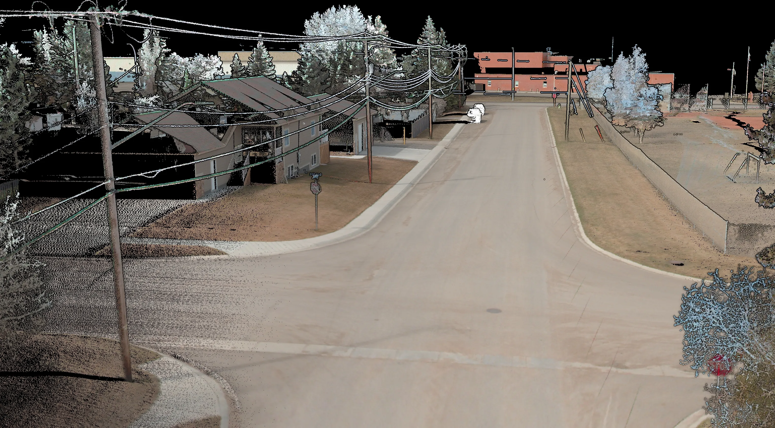
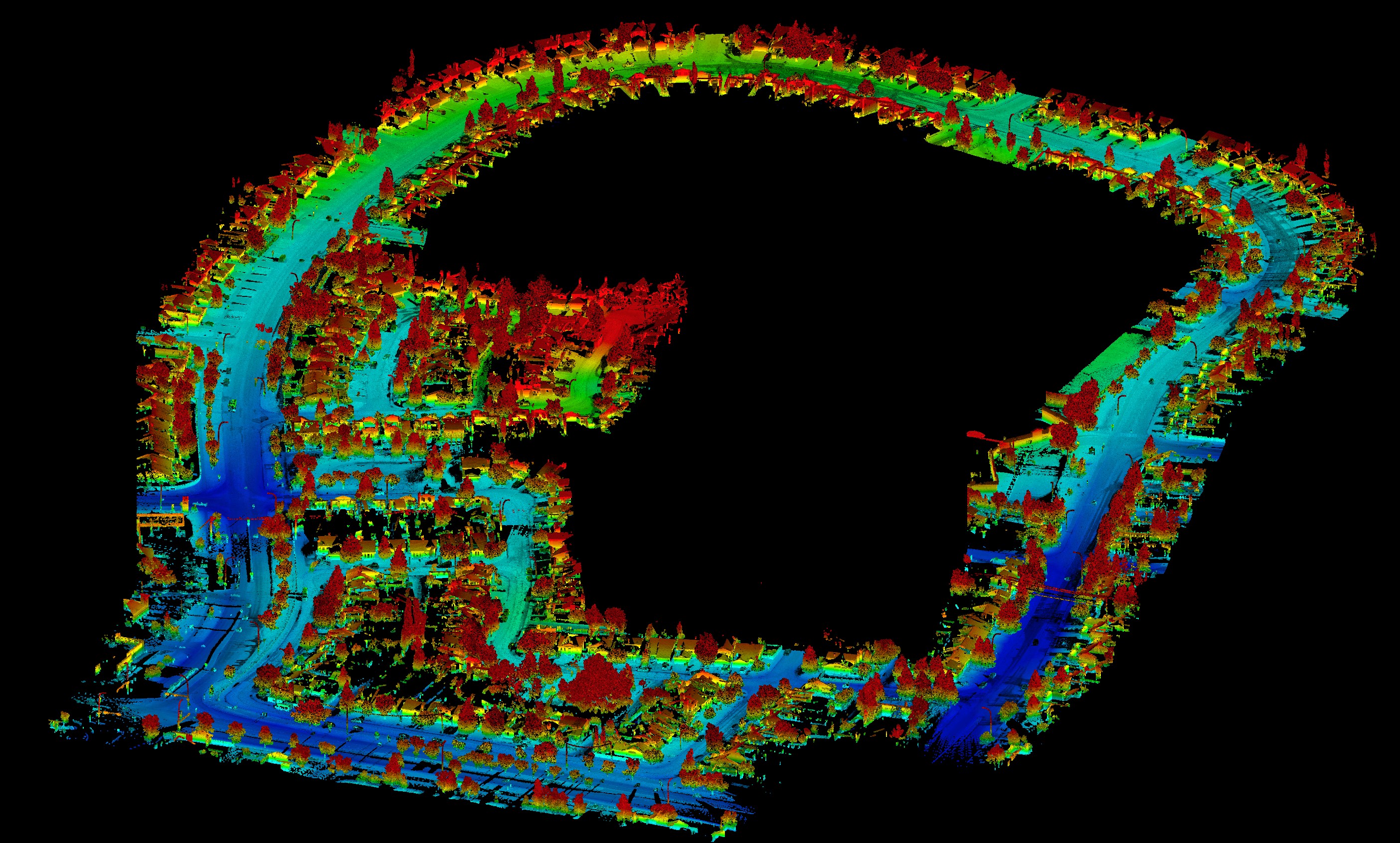
3D Town Mapping — Mobile LiDAR
Vehicle-mounted LiDAR scan of an entire town network for asset management, road condition, and GIS integration.
View all projectsMobile Mapping for Alberta's Key Industries
Roads & Highways
- High-speed corridor mapping with dense point clouds and 360 degree imagery
- Asset inventory (signs, guardrails, pavement condition)
- Clearance analysis, encroachment detection & as-built verification
Rail & Transportation
- Rail line & right-of-way scanning at operational speeds
- Bridge, tunnel & overpass documentation
- Track geometry, clearance & deformation monitoring
Utilities & Energy
- Pipeline & powerline corridor asset mapping
- Utility pole extraction and vegetation encroachment
- Plant & facility interior scanning
Municipal, Urban & Industrial
- Streetscape, sidewalk & urban asset inventory
- Digital twin creation for cities and industrial sites
- Interior & GPS-denied scanning (buildings, tunnels, parkades)
Platforms
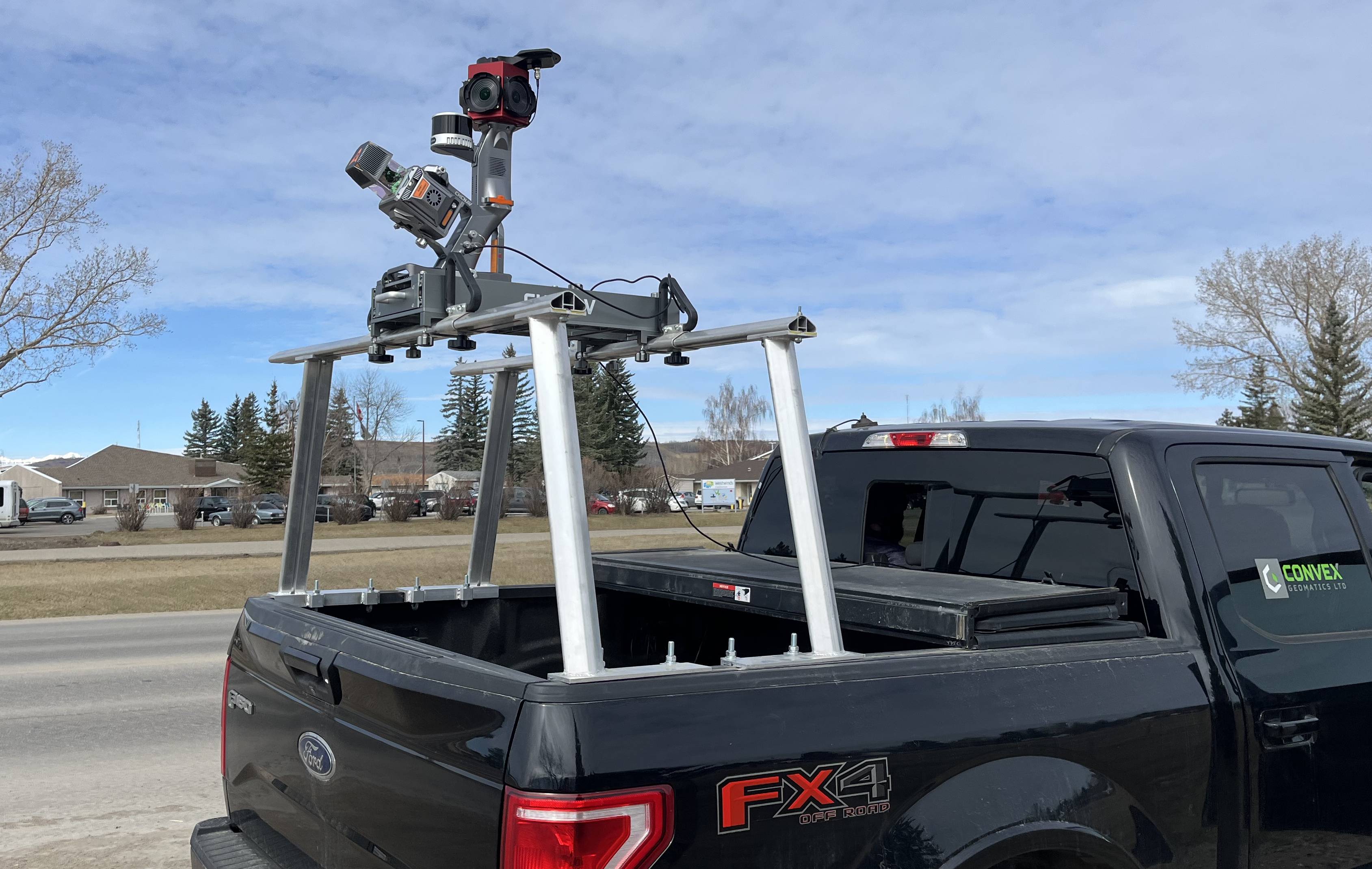
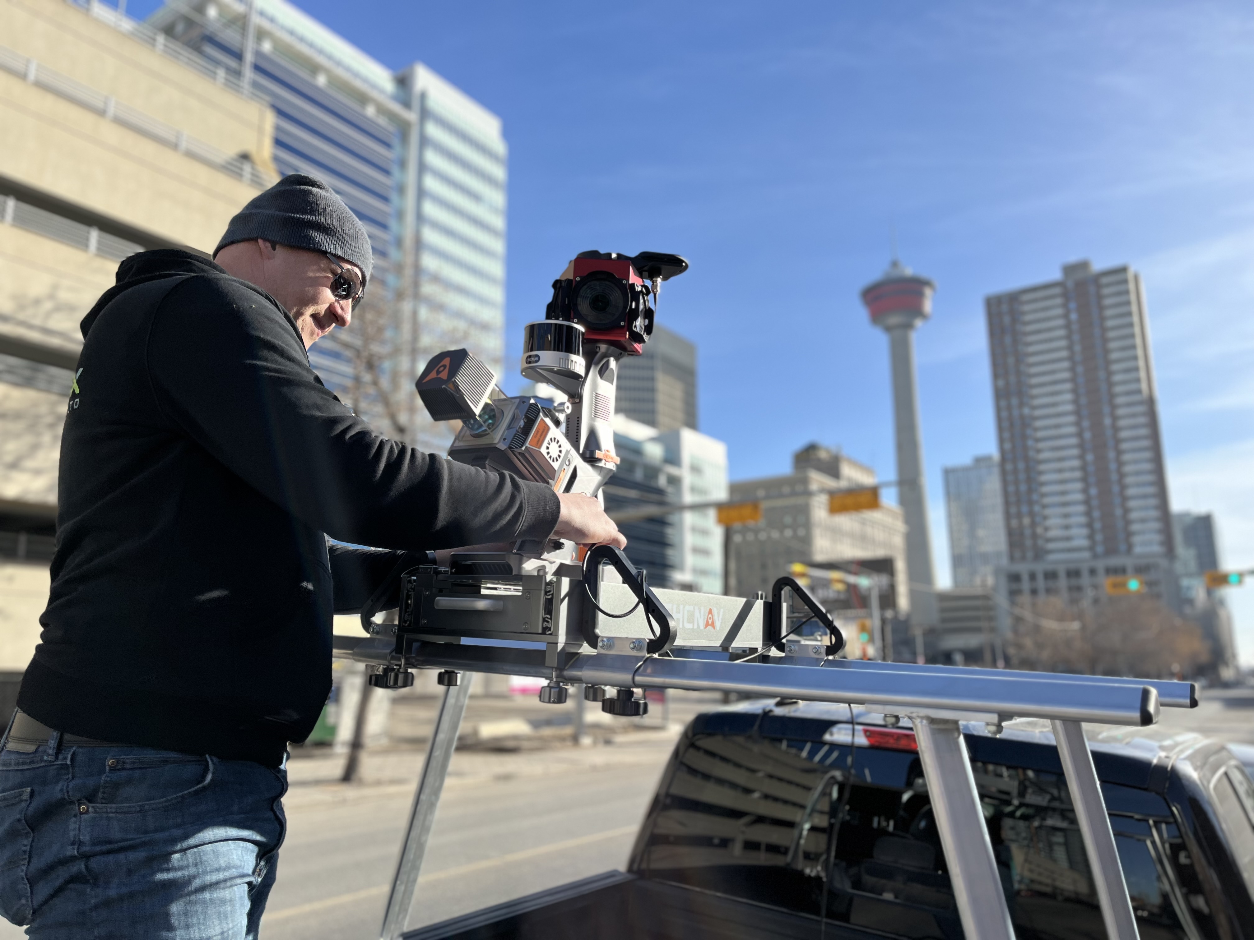
 Vehicle-Mounted
- Multiple scanners for 360° coverage
- GNSS/IMU trajectory & control integration
- HD panoramic imaging
- Rapid corridor acquisition at highway speeds
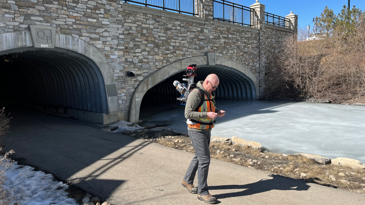
 Handheld SLAM
- Indoor & GNSS-denied capture (buildings, plants, tunnels)
- Rapid as-builts, floor plans & volume checks
- Lightweight for tight/complex spaces
- Real-time SLAM with loop-closure; aligns to site control
 Backpack LiDAR
- No-fly / no-vehicle corridors (parks, trails, pathways)
- High-detail under canopy with minimal disturbance
- Long-path SLAM with loop-closure; ties to control
- Fuses with vehicle/UAV data for complete coverage
 UAV Integration
- Data fusion for occlusions & verticals
- Comprehensive site coverage
- Consistent datums & projections
- Unified deliverables across platforms
Deliverables
 Core Outputs
- Classified point clouds (LAS/LAZ)
- Colorized points & 3D models
- Trajectory & metadata
- 360° imagery (optional)
 Processed Data
- Vectorized features
- Clearances, cross-sections & profiles
- Feature extraction & asset inventory
- Change detection / condition