Overview
Convex Geomatics Ltd. specializes in Construction Layout, Monitoring & Control for building, civil, and industrial projects across Alberta and Western Canada. We establish tight primary/secondary control, perform site calibrations with independent check shots, and maintain a single source of truth so field crews, designers, and contractors are working from the same coordinates and versions at all times.
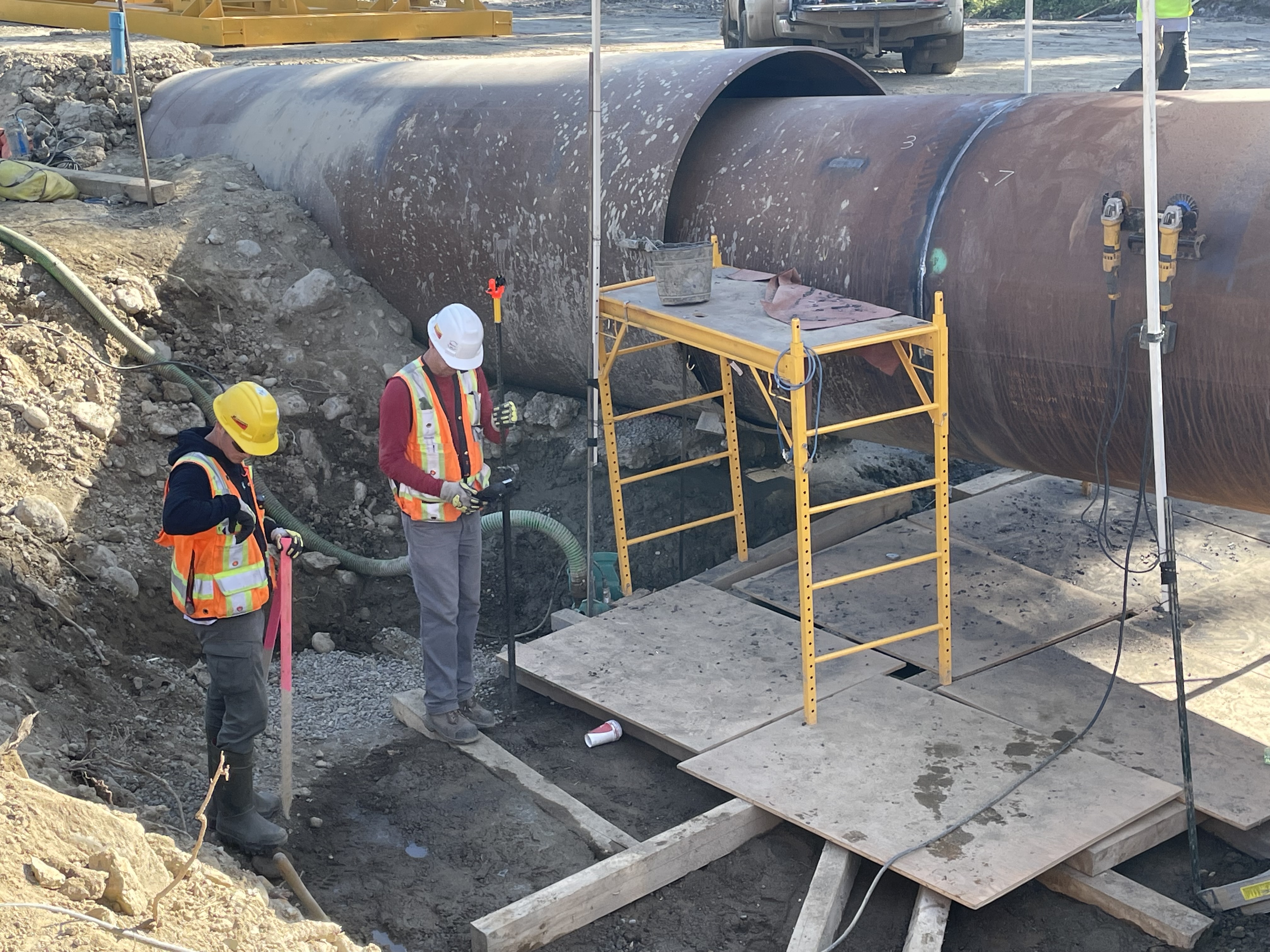
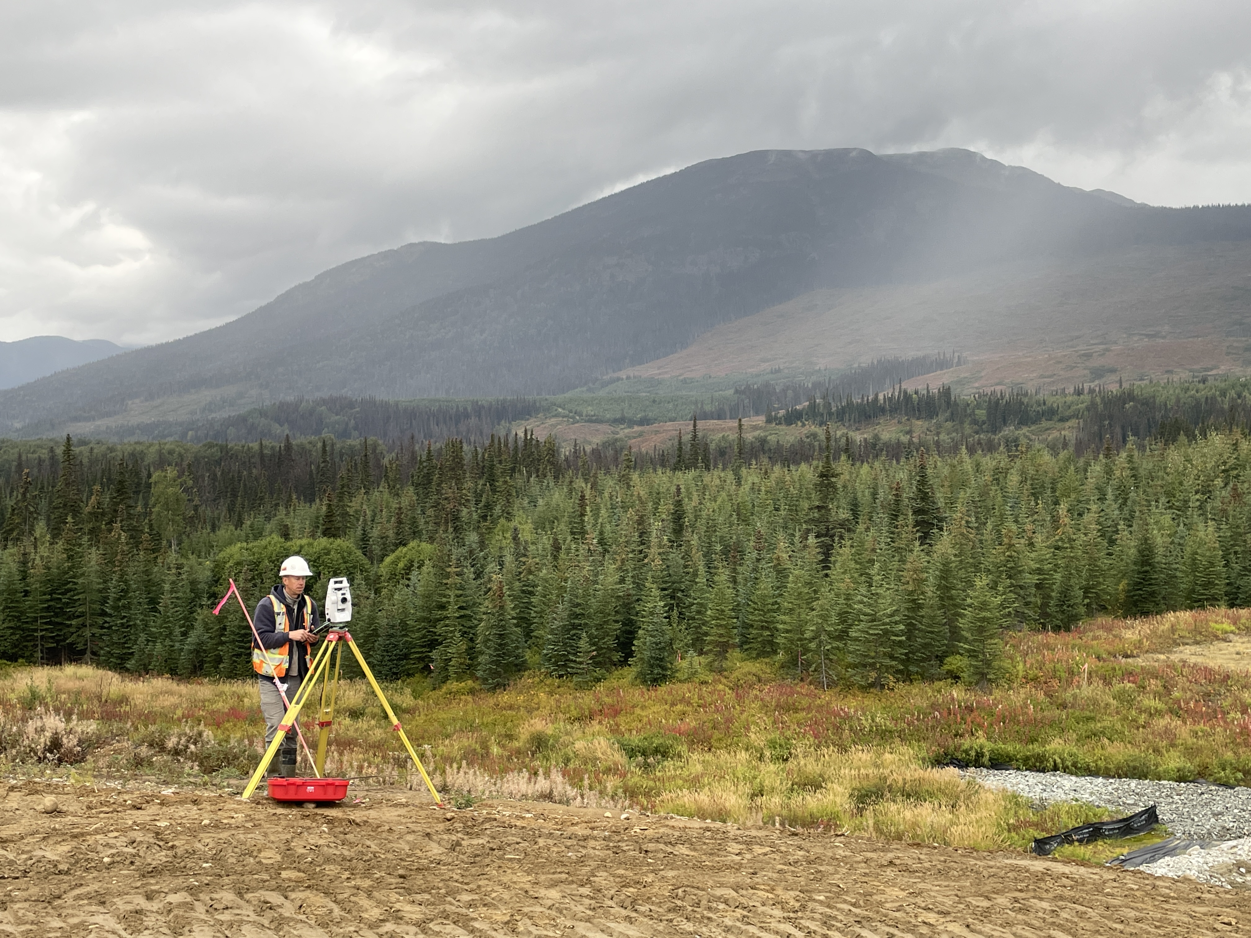
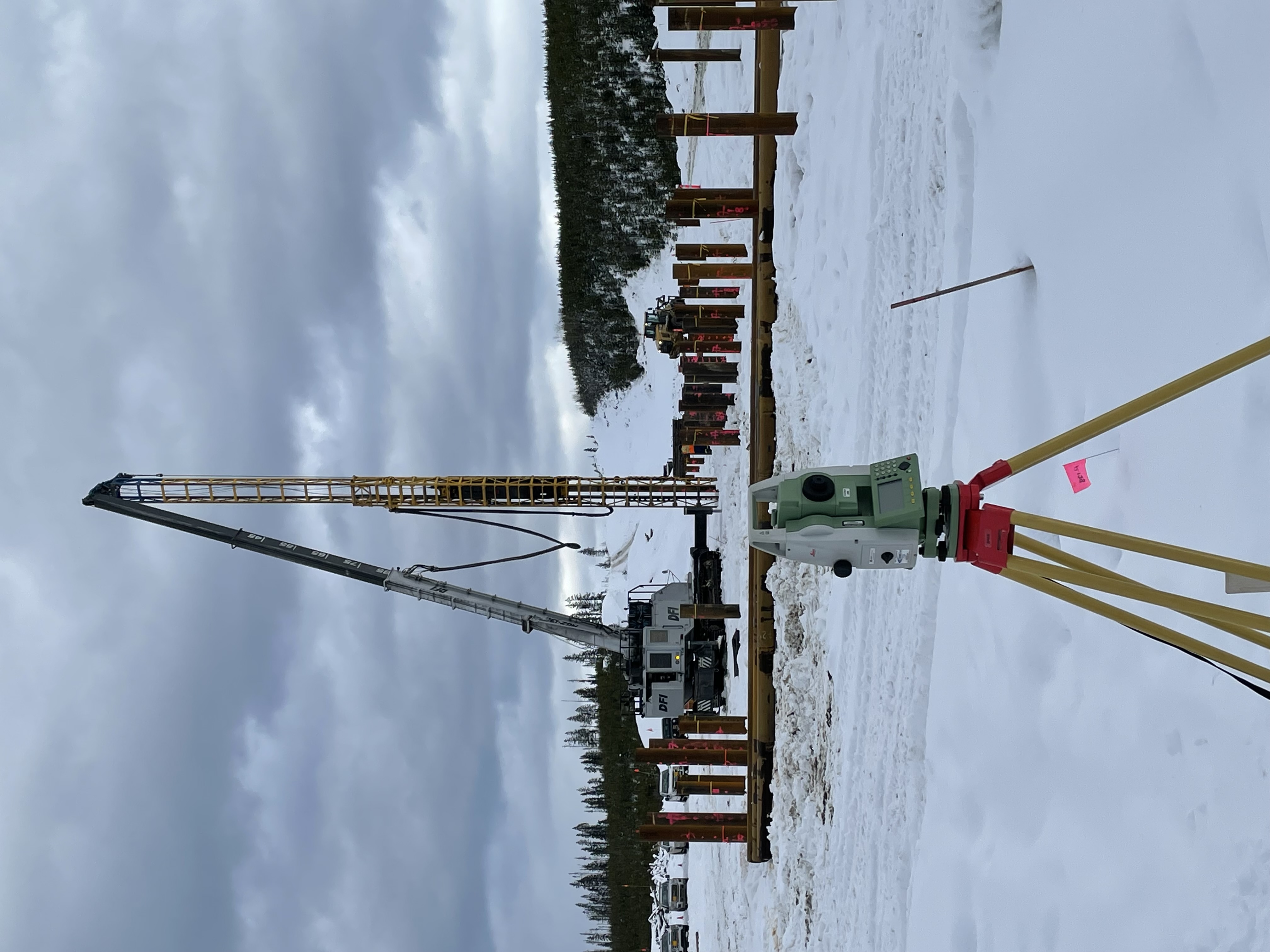
Construction Layout. From gridlines, foundations, anchor bolts, and embeds to utilities, curb & gutter, paving, and earthworks, our crews use GNSS RTK/PPK and robotic total stations to stake, verify, and document to your specified tolerances. We provide clear stake reports and hold-point sign-offs, plus rapid re-stakes as designs evolve to keep schedules on track.
Monitoring & Verification. We deliver settlement and deformation monitoring using prisms/targets, reflectorless shots, and scan-to-model comparisons—producing trend charts, deviation heatmaps, and alert thresholds for proactive decision-making. Critical as-builts (inverts, slab elevations, rails, embedded plates) are checked against design with transparent QA/QC and independent checks.
Machine Control & Data Management. We build and maintain machine control models—surfaces, alignments, linework—and manage revisions/versions so operators always have current files. Controller-ready deliverables are provided for major platforms (e.g., Trimble, Topcon, Leica), along with CAD handover (Civil 3D/MicroStation) and a clear change log for full traceability.
*Subject to specification, site conditions, and control quality.
Deliverables
 Field & Layout
- Stakeout of alignments, grids, bolt patterns, utilities, curb/gutter
- Cut/fill and elevation checks; hold points sign-off
- Digital stakeout reports with photos and coordinates
 Models & As-Built
- Machine control files (surfaces, lines, alignments)
- As-built drawings, point clouds, and comparison heatmaps
- Clash/clearance and tolerance check reports
 Formats
Layout Services
 Civil & Earthworks
- Roadways, grading, pads, and pipe networks
- Curbs/gutters, sidewalks, medians, lane lines
- Stockpile volumes & progress quantities
 Structural & Industrial
- Anchor bolts, column lines, baseplates
- Rack/silo plumbness and positional checks
- MEP sleeves and embeds verification
 Machine Control
- Surface models and alignments with QA
- Controller-ready files, site calibrations
- Ongoing updates and revision tracking
Monitoring
 Deformation & Settlement
- Prism networks and reflectorless shots
- GNSS campaigns for long-baseline trends
- TLS change detection and heatmaps
 Reporting & Alerts
- Threshold-based notifications
- Time-series plots and dashboards
- Stamped reports with methods and stats
 Outputs
Workflow
- Pre-construction — project control, site calibration, model review
- Stakeout — robotic TS/GNSS stake to design; hold points sign-off
- As-built — scan/measure and compare to model/tolerances
- Machine control — prepare/update surfaces and alignments
- Monitoring — establish baselines and observe at set frequency
- QA/QC — checks, residuals, and documented acceptance
- Handover — final drawings, reports, and data packages
Technology
 Instruments
- Robotic total stations and digital levels
- GNSS RTK/PPK with network/base support
- Handheld SLAM LiDAR
CAD/BIM & Field Ecosystem
File Support
Control & QA
Control
- Primary/secondary control with redundancy
- Site calibration and validation checks
- Benchmark maintenance and protection
 QA/QC
QA/QC
- Independent check shots and closure
- Residuals, RMSE (H/V), tolerance summaries
- Full sign-off documentation
 Handover
- As-built CAD, PDFs, CSVs, and point clouds
- Machine control updates and archive
FAQ
Need precise layout or continuous monitoring?
We’ll align tolerances, formats, and QA to your construction specs.