
Overview
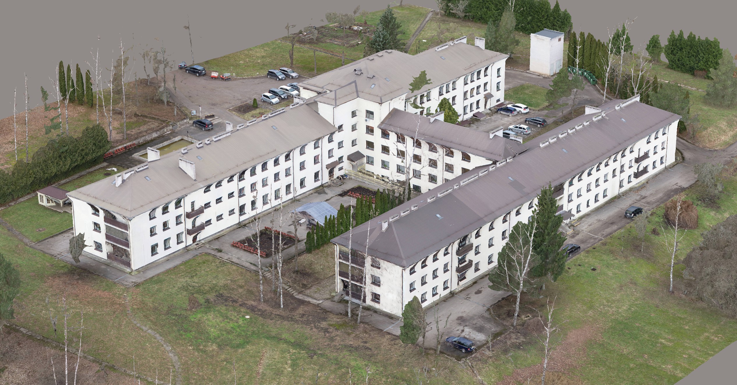
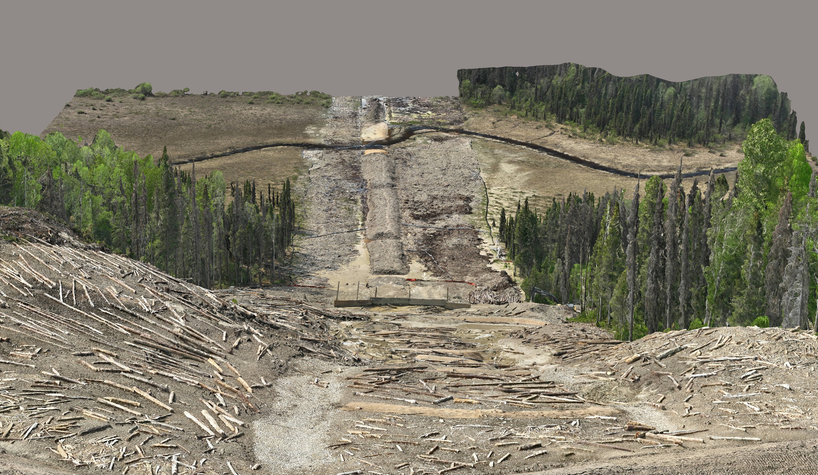
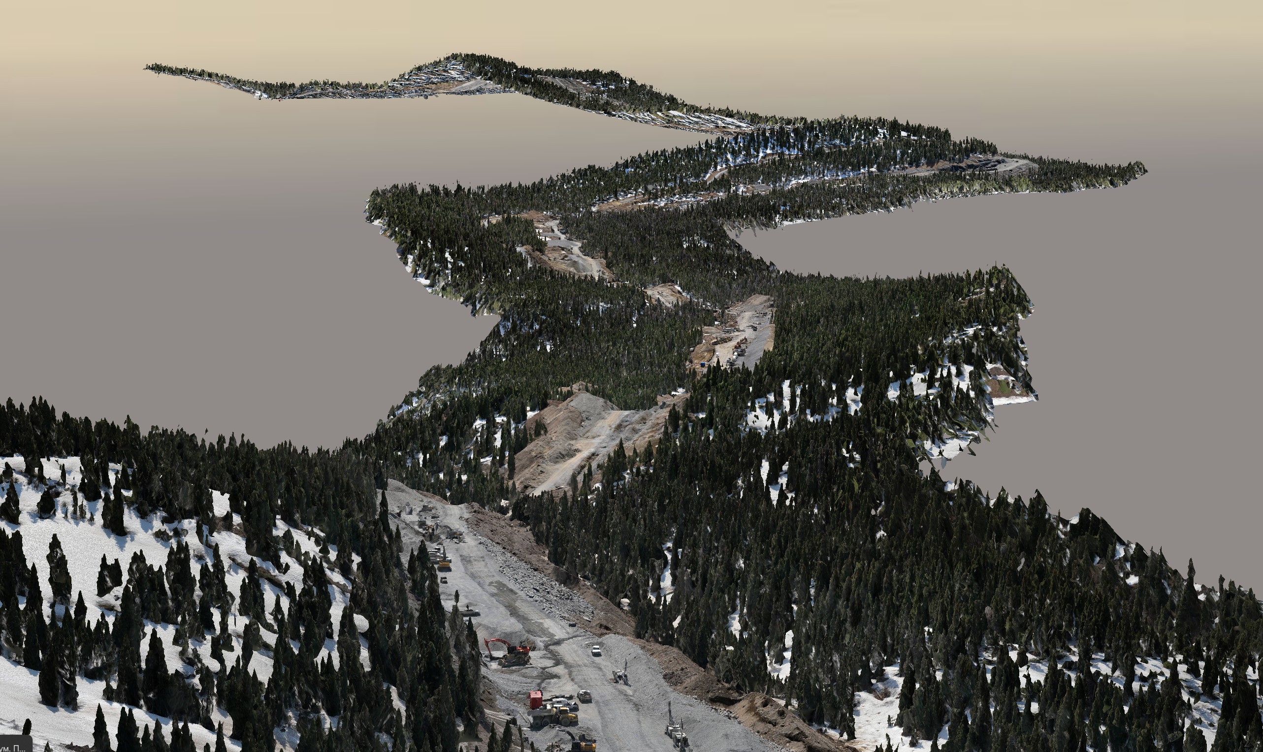
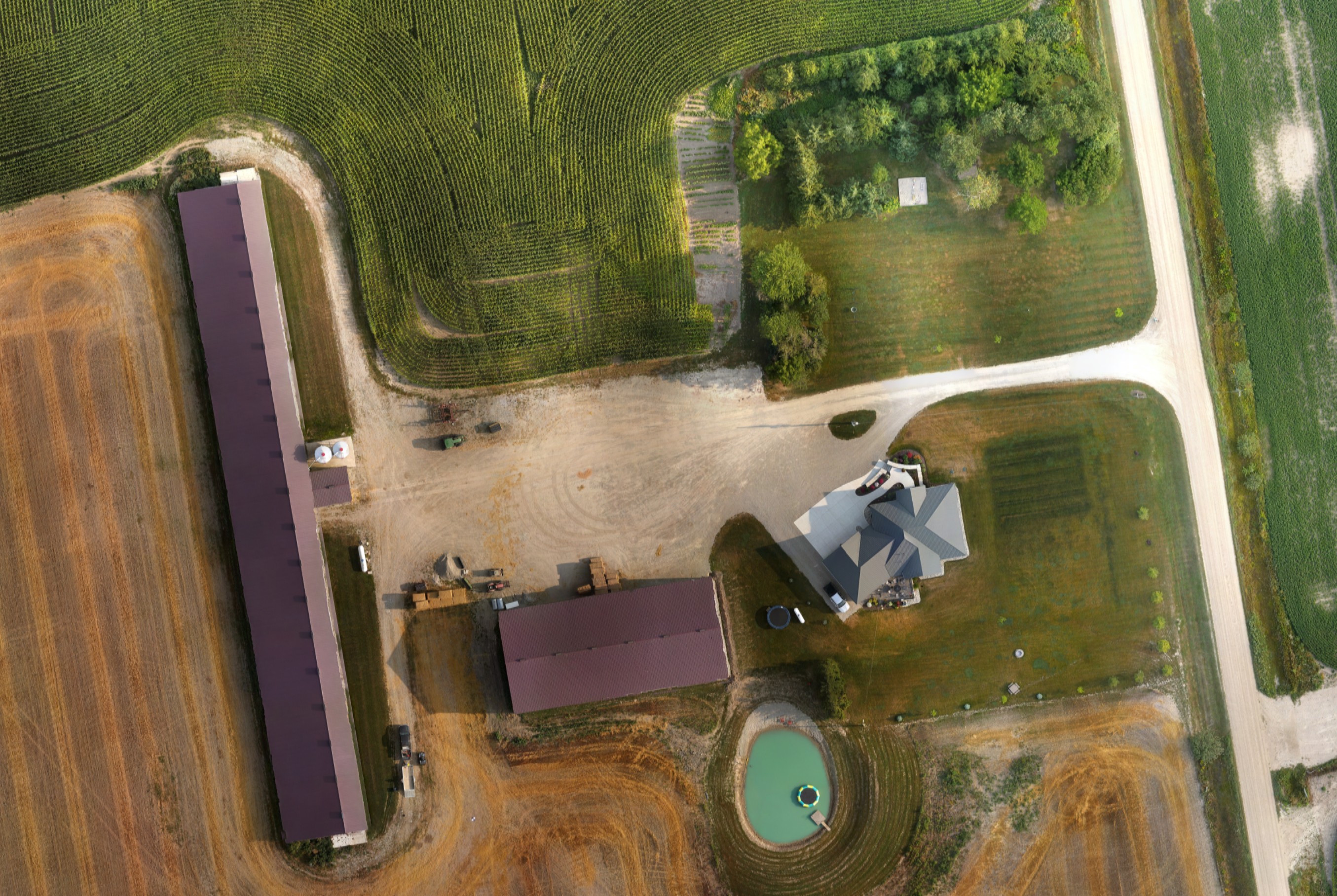
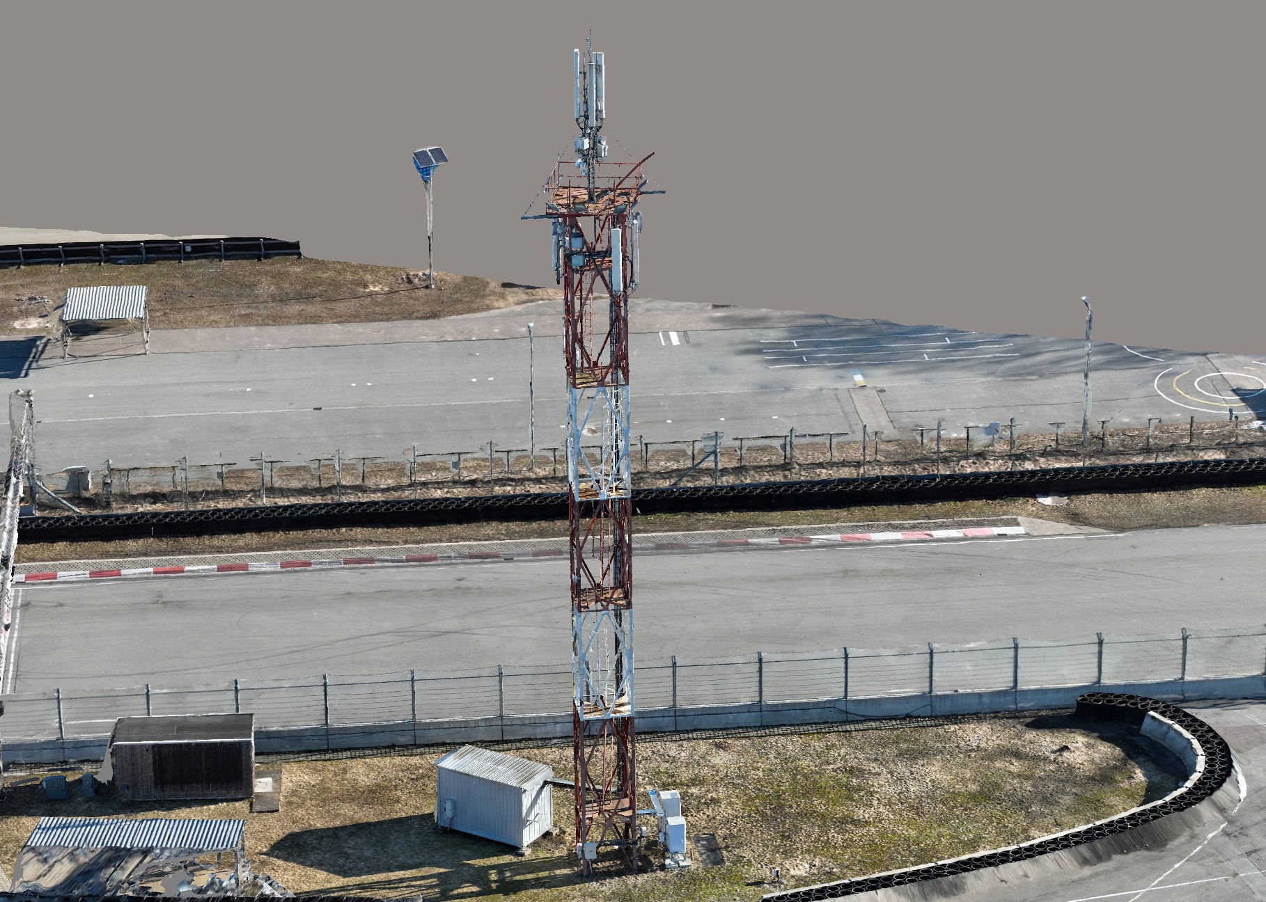
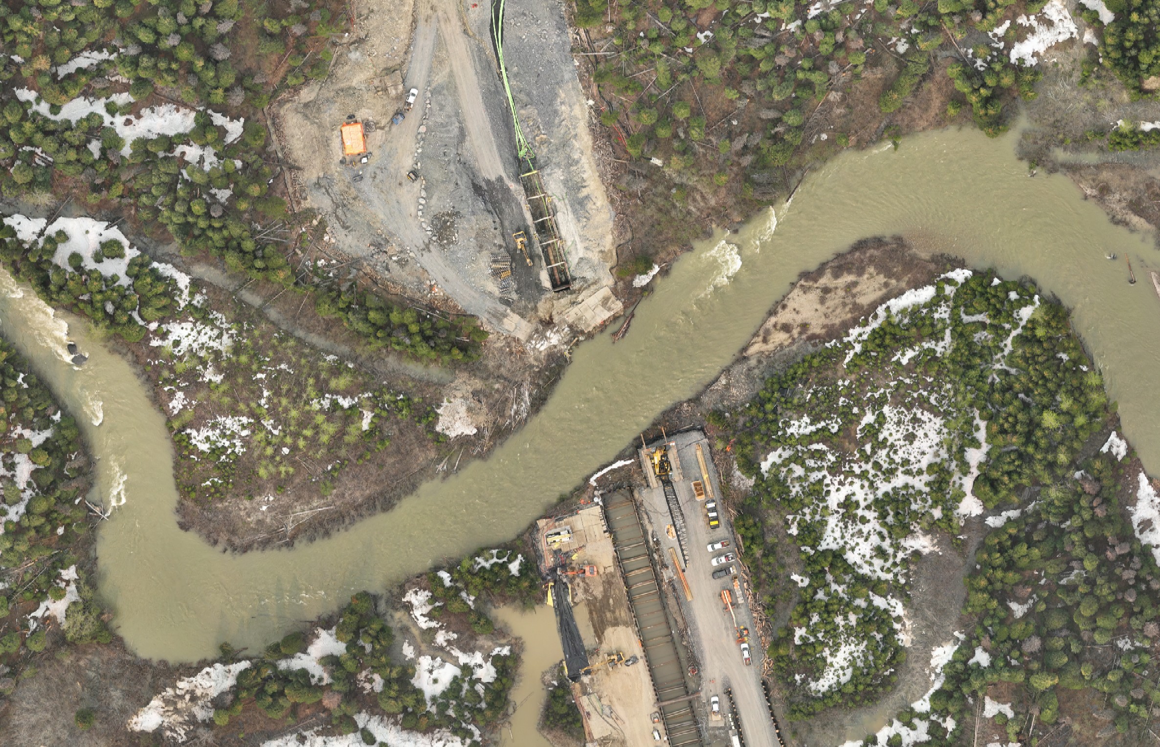
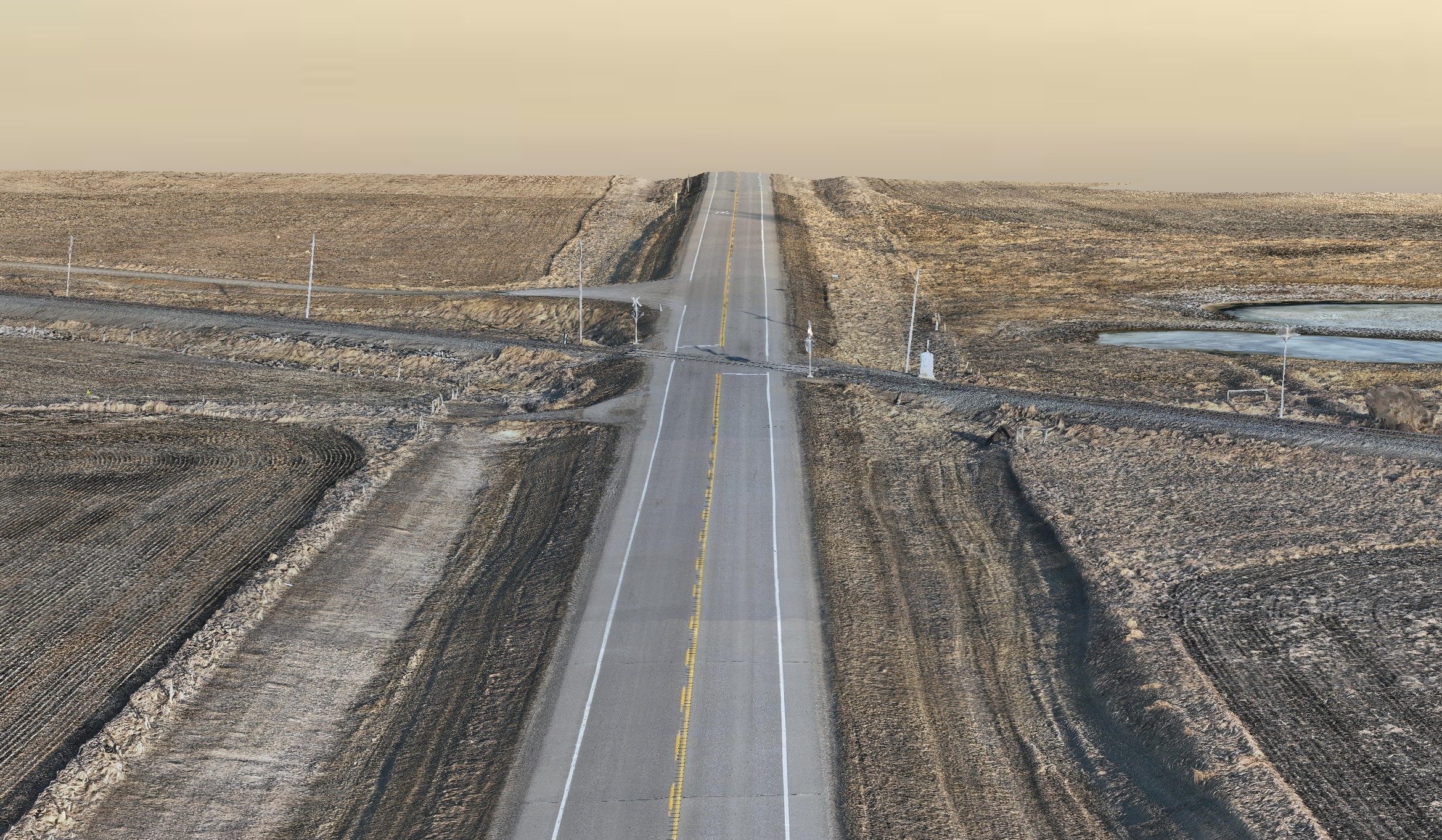
Convex Geomatics Ltd. delivers professional UAV (drone) and manned aircraft (helicopter & fixed-wing airplane) aerial mapping across Western Canada. Using survey-grade photogrammetry workflows, we produce high-resolution orthomosaics/orthophotos, dense point clouds, DSM/DTM, and textured 3D meshes. Ground control and a documented QA/QC process ensure dependable accuracy for planning, design, construction monitoring, and asset management.
Built on advanced cameras and state-of-the-art processing, our photo maps routinely achieve up to ~1.5 cm/pixel where conditions allow—providing crisp, decision-ready visuals. We select the right platform for each site—helicopters for detailed or access-constrained areas, fixed-wing aircraft for efficient corridor/large-area coverage, and UAVs for precise, lower-altitude capture—and can blend collections for seamless, design-ready results.
Beyond orthophotos, we build engineering-ready 3D deliverables: site and building 3D models, textured meshes, and photorealistic Gaussian splats (3DGS) for smooth, real-time viewing and collaboration. Outputs are packaged for BIM/GIS ecosystems—glTF/OBJ, LAS/LAZ, tiled rasters—and slot cleanly into Civil 3D, MicroStation, ArcGIS, and modern web viewers.
Typical use cases include design coordination, progress tracking, cut/fill & volumetrics, as-built documentation, asset inventory, and context models for stakeholder engagement. Where canopy or structure limits imagery alone, we can fuse aerial photogrammetry with LiDAR and ground surveys to deliver complete, consistent terrain and structure models.
*Dependent on control quality, surface texture, and scene complexity.
Deliverables
 Orthophotos
- Georeferenced mosaics (GeoTIFF / COG optional)
- True-ortho options for urban & vertical structures
- Web map tiles (XYZ / WMTS) for fast viewing
 Surface Models & Clouds
- DSM/DTM rasters with contours
- Photogrammetric point clouds (LAS/LAZ)
- Breaklines & hydro-enforced/flattened surfaces
3D Models
- Textured meshes (OBJ/FBX)
- 3D Tiles / SLPK for digital twins & web GIS
- Photoreal Gaussian splats (3DGS) & glTF
 Formats
Workflow
- Mission planning — airspace & permits, GSD/overlap, flight lines & safety.
- Platform selection — UAV, helicopter, or airplane matched to scope.
- Acquisition — calibrated cameras/IMU with consistent altitude & lighting.
- Control & georeferencing — GCPs & independent checkpoints; RTK/PPK.
- Photogrammetry — alignment, bundle adjustment & dense reconstruction.
- Surfaces & ortho — DSM/DTM, hydro-enforcement/flattening, contours, true-ortho.
- 3D & digital twin — textured meshes, 3D Tiles/SLPK, glTF, Gaussian splats (3DGS).
- Packaging & QA/QC — CAD/GIS deliverables, projections/metadata, residuals & coverage.
Technology
 Sensors
- High-resolution RGB cameras (nadir & oblique) on UAV, helicopter & airplane platforms
- RTK/PPK GNSS with IMU for precise direct georeferencing
- Stabilized gimbals, synchronized capture & calibrated optics
- Survey control with ground targets & independent checkpoints
 Processing & AI
- Photogrammetric alignment, bundle adjustment & dense reconstruction
- Automated QA on tie points, overlap, residuals & completeness
- ML-assisted feature extraction (stockpiles, pavement/roofs, vegetation)
- 3D publishing: textured meshes, 3D Tiles & Gaussian splats
 Coordinate Support
- All common EPSG codes & custom site grids
- Orthometric (geoid) & ellipsoidal heights
- Metric/imperial units with full metadata & README
Standards & QC
 Quality
- Independent checkpoints (RMSE H/V), residual tracking & bundle diagnostics
- True-ortho validation: lean minimization, seamline review & artifact cleanup
- Radiometry QA: color balance, exposure consistency & haze/glare mitigation
 Documentation
- Audit-ready QA/QC report with control diagrams, accuracy stats & coverage heatmaps
- Data lineage: acquisition notes, processing versions & change log
- CRS details: projection, vertical datum/units, tiling & layer schema definitions
 Handover
- Layered CAD/GIS packages with README & embedded metadata
- Cloud-ready outputs: COG orthos, XYZ/WMTS tile pyramids & 3D Tiles/glTF