
Choosing between LiDAR and photogrammetry is one of the most important decisions in modern surveying. In Alberta's highly variable terrain — from dense boreal forests to open prairies and complex urban environments — selecting the wrong method can lead to inaccurate models, costly delays, or incomplete datasets.
Both technologies are powerful. But they are not interchangeable. The key is understanding when each method performs best — and where it fails.
Bottom line: LiDAR excels where vegetation or terrain complexity exists. Photogrammetry wins where surfaces are open, visible, and cost efficiency matters.
How LiDAR and Photogrammetry Actually Work
LiDAR (Light Detection and Ranging)
- Active sensor — emits laser pulses
- Measures distance based on return time
- Penetrates vegetation using multiple returns
- Produces true 3D point clouds independent of lighting

Photogrammetry
- Passive sensor — uses RGB images
- Reconstructs 3D surfaces using overlapping photos
- Requires visible surfaces and good texture
- Produces dense surface models and high-resolution orthophotos

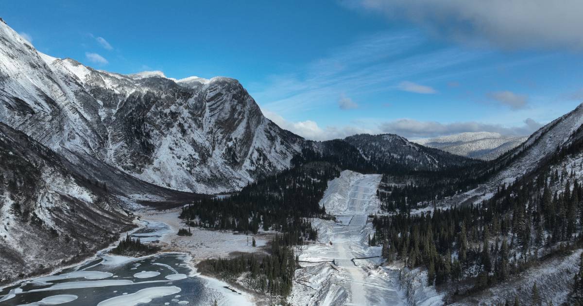
The Alberta Reality: Why Terrain Changes Everything
Alberta is not a uniform environment. Survey conditions change dramatically across short distances:
- Dense forests in northern Alberta
- Rolling foothills and steep river valleys
- Flat agricultural prairie with minimal obstruction
- Urban infrastructure, industrial sites, and active construction zones
This variability is exactly why a one-method-fits-all approach fails.
Where LiDAR Wins (and It's Not Even Close)
1. Forested Areas
- LiDAR penetrates canopy and captures the true ground surface
- Photogrammetry mainly sees treetops and upper vegetation
Result: Photogrammetry is unsuitable for ground models in dense forest. LiDAR is essential.
2. Powerlines, Pipelines, and Corridors
- LiDAR can detect wires, structures, slopes, and vegetation encroachment
- Photogrammetry struggles with thin objects and vertical separation
3. Complex Terrain
- LiDAR produces consistent vertical accuracy on embankments, cuts, and riverbanks
- Photogrammetry can introduce smoothing, noise, and edge errors
4. Low Light or Overcast Conditions
- LiDAR is largely independent of ambient lighting
- Photogrammetry quality depends heavily on image quality and light consistency
Where Photogrammetry Wins
1. Open Fields and Agricultural Land
- Flat terrain with visible surfaces and minimal vegetation obstruction
- High-resolution orthophotos can be as valuable as the surface model itself
2. Visual Deliverables
- True-color orthomosaics
- Realistic textured 3D meshes for presentation and planning
3. Budget-Sensitive Projects
- Lower equipment and acquisition cost for straightforward sites
- Efficient for broad surface mapping when no canopy penetration is needed
Important: Photogrammetry is not a replacement for LiDAR — it is a different tool for different site conditions.
Direct Comparison
| Feature | LiDAR | Photogrammetry |
|---|---|---|
| Vegetation penetration | ✓ Yes | ✗ No |
| Ground accuracy in forests | ✓ High | ✗ Poor |
| True-color output | Optional | ✓ Excellent |
| Lighting dependency | ✓ Low | ✗ High |
| Corridor / wire detection | ✓ Strong | Limited |
| Cost | Higher | ✓ Lower |
The Best Approach: Combine Both
In many Alberta projects, the strongest workflow is not choosing one over the other — it is combining both technologies:
- LiDAR for accurate geometry and terrain
- Photogrammetry for visual detail, orthophotos, and textures

This combined approach is especially valuable for:
- Engineering design and topographic control
- Construction planning and monitoring
- Environmental analysis and terrain interpretation
How to Choose (Simple Rule)
Use LiDAR if: vegetation, vertical complexity, or terrain accuracy matters.
Use Photogrammetry if: the site is open, visible, and the priority is lower cost or visual output.
Why Convex Geomatics
Convex Geomatics specializes in both LiDAR and photogrammetry across Alberta, delivering the right solution for each project — not just the most convenient one.
- UAV LiDAR for terrain, corridor, and vegetation-challenged sites
- High-resolution photogrammetry for orthophotos and visual models
- Integrated deliverables for CAD, GIS, and engineering workflows
Not Sure Which Method You Need?
We'll recommend the right approach based on your terrain, accuracy requirements, and budget — no guesswork.
Related Reading from Our Blog
- LiDAR in Forestry and Dense Vegetation: What Actually Works — LiDAR in dense forest canopy
- Stockpile Volumetrics: Comparing UAV LiDAR, Photogrammetry & Traditional GPS — stockpile method comparison
- Not All LiDAR Services Are Equal — what to look for in a LiDAR provider