
Overview
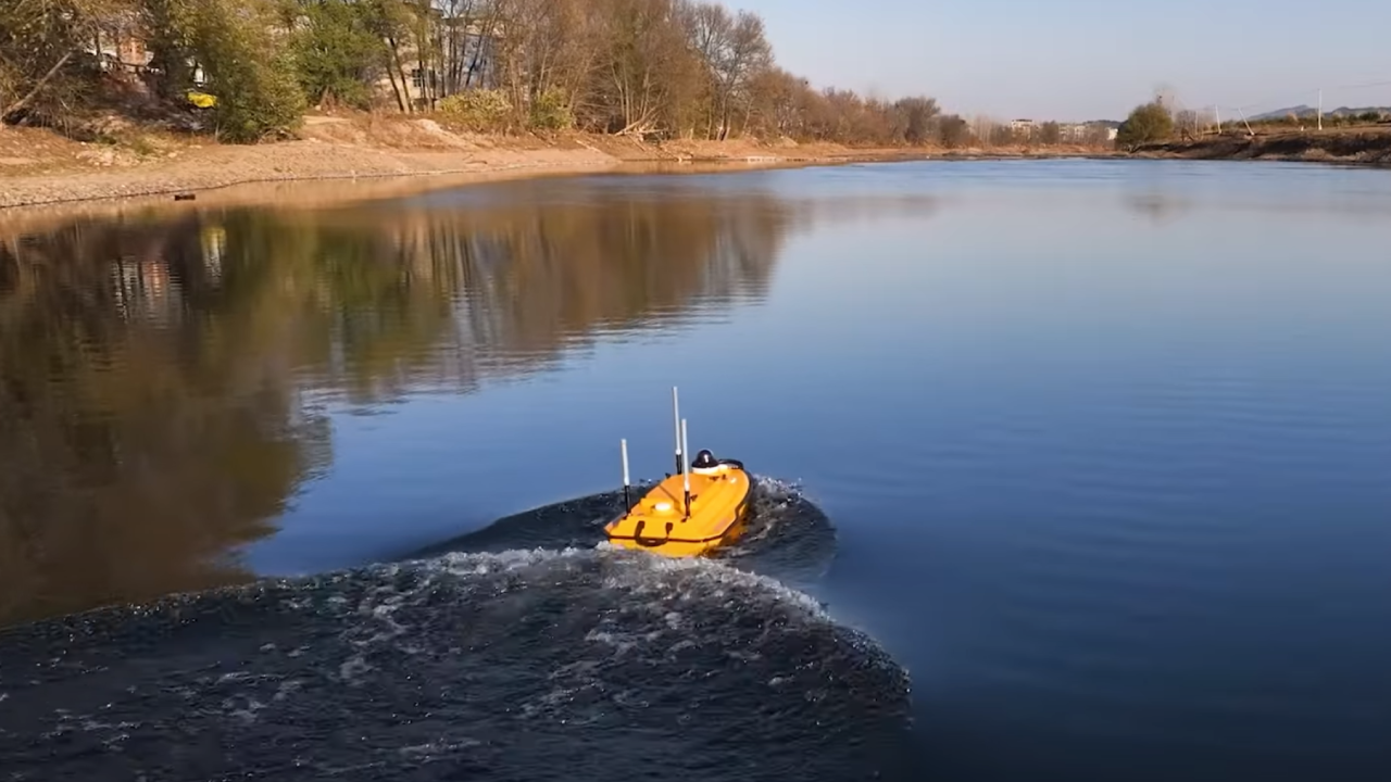
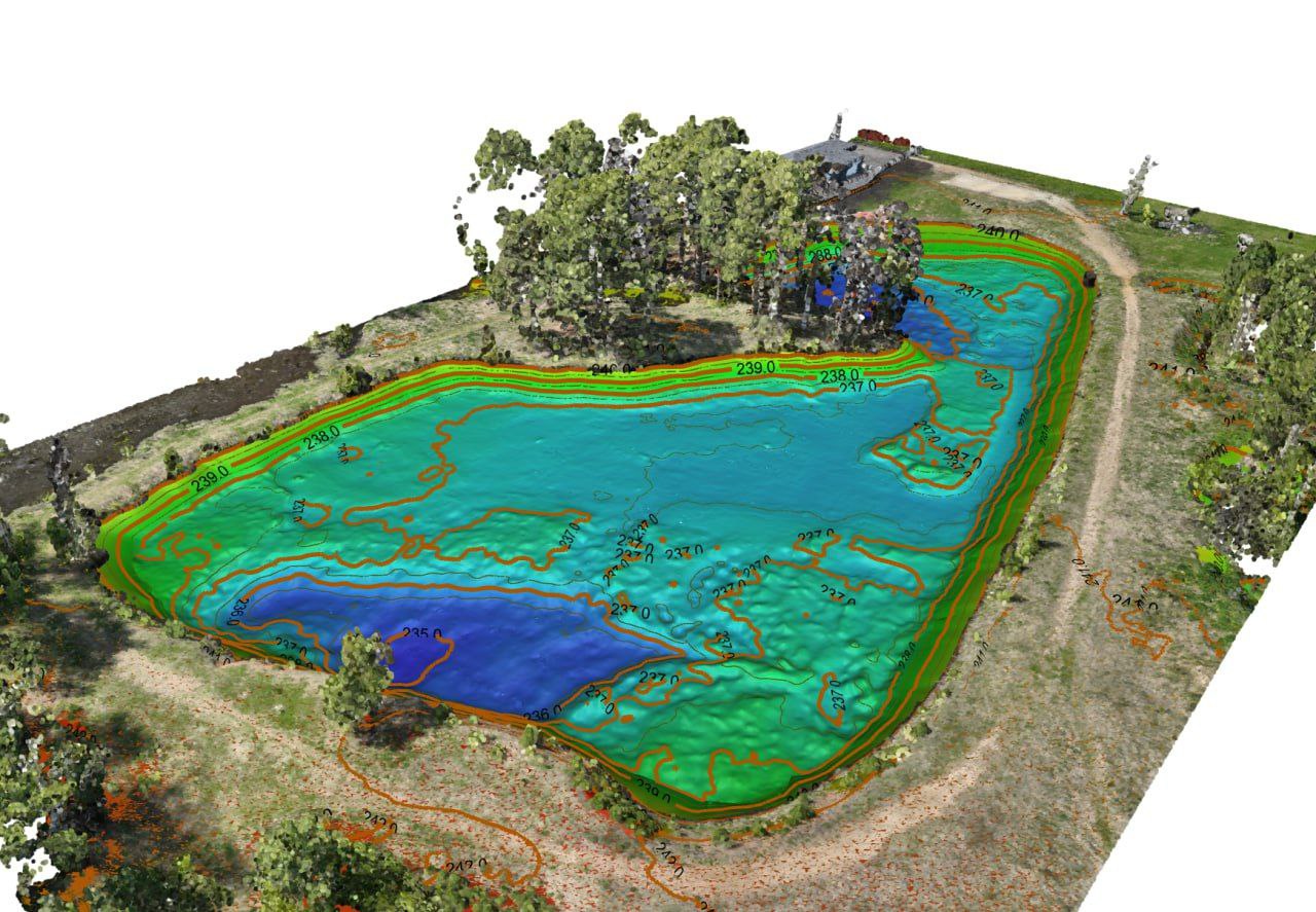
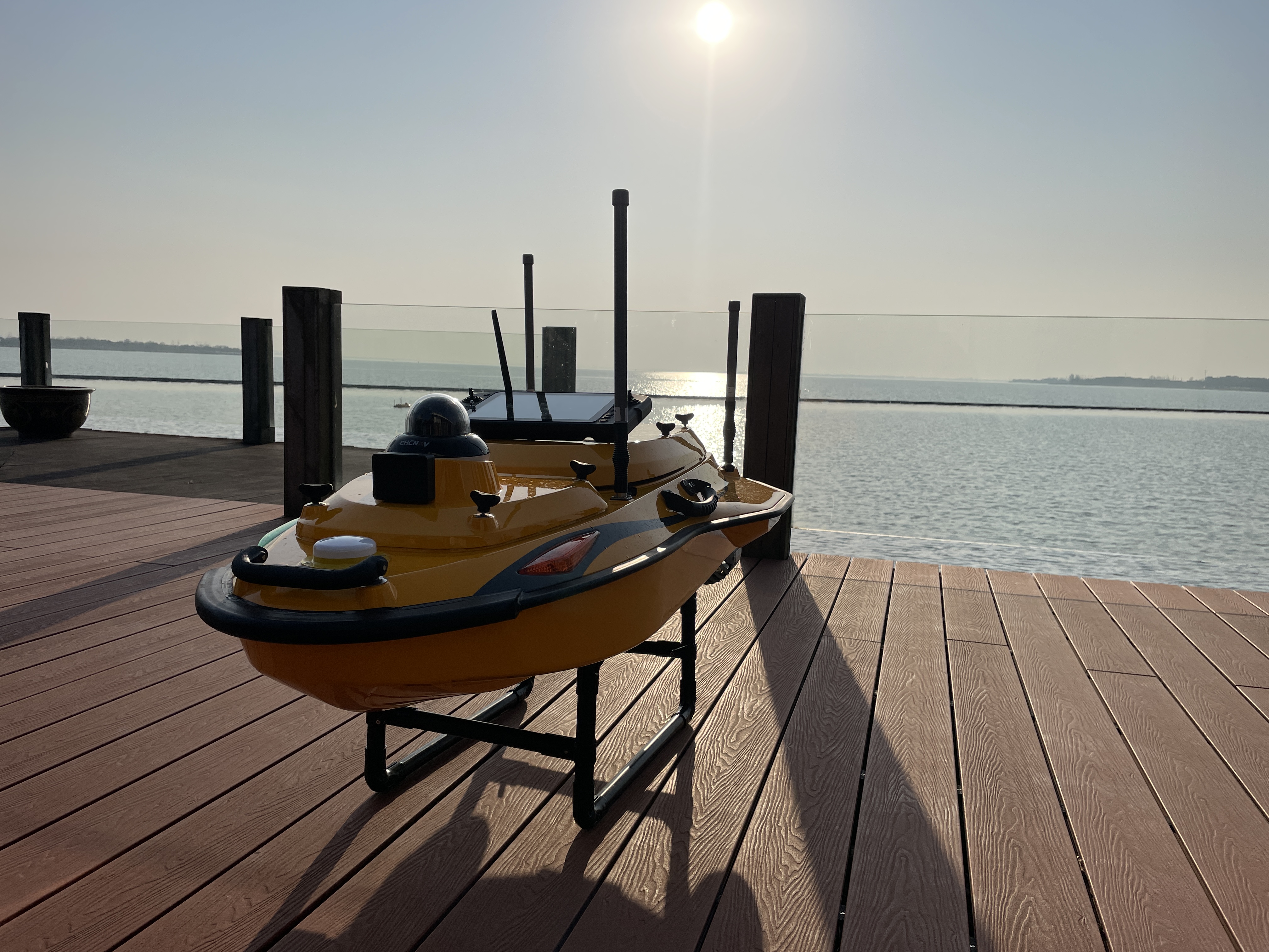
We perform survey-grade hydrographic/bathymetric mapping with a single-beam echo sounder (SBES) on an unmanned surface vessel (USV), safely capturing reliable depths in rivers, canals, reservoirs, storm ponds, harbours, and around bridges and intakes. The USV keeps crews off the water, works close to edges with minimal wake, and launches from tight access points-ideal for busy worksites and sensitive habitats. Where conditions allow, the system maps to 200 m depth and can be combined with aerial/terrestrial LiDAR to produce a seamless topo-bathymetric surface. Deliverables include clean soundings, bathymetric terrain and contours, and cross-sections packaged for CAD/GIS to support engineering, dredging, and asset management.
*Depends on environment, sound-velocity stability, and control quality.
Why Choose Convex Geomatics for Bathymetric Surveys in Alberta
- Calgary-based team with deep local knowledge of Alberta waterways and regulations
- USV technology for safer, faster, and more environmentally friendly surveys
- Seamless integration with our UAV LiDAR and topographic surveying services
- Engineering-grade deliverables tailored for consultants, municipalities, and energy clients
- Proven workflows with full QA/QC documentation and vertical datum control
Deliverables
 Core Outputs
- Soundings (XYZ/CSV) with QA codes
- Bathymetric DTM/DSM (GeoTIFF) with hillshade
- Contours (0.25–1.0 m)
 Engineering Products
- Cross-sections, profiles, alignment sheets
- Scour & siltation/volume change assessments
- Shoreline & structure mapping (bridges, intakes, outfalls)
Workflow
- Planning & permits, safety, datum/level strategy
- Calibration: patch test, bar-check, latency/motion checks
- Acquisition: SBES lines, overlaps, shoreline tie-ins
- Corrections: tide/RTK water-level, SVP/refraction, heave
- Cleaning: automated filters & manual QA
- Gridding & modeling: DTMs, contours, sections
- QA/QC & reporting: check lines, statistics, coverage
- Delivery: CAD/GIS packages & documentation
Technology
 Sonar & Sensors
- Singlebeam echosounder (SBES)
- IMU for heave, pitch, roll, yaw
Positioning
- RTK/PPK GNSS with local control
- RTK level corrections
- Chart/project vertical datums