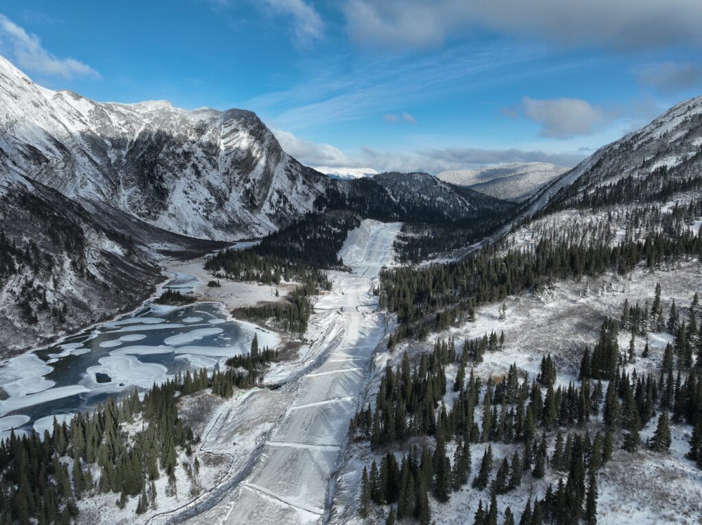
At Convex Geomatics, we are proud to have contributed our expertise to significant infrastructure projects, including the Coastal GasLink pipeline. Working with reputable partners like CGL and SA Energy, our team delivered high-precision survey services tailored to the specific needs of large-scale pipeline construction.
Our contributions to these projects include:
Structural Monitoring: Ensuring the stability and integrity of pipeline structures with precise monitoring and real-time data analysis.
Survey Control Establishment: Establishing accurate and reliable survey control networks essential for all construction phases.
LiDAR Scanning: Leveraging advanced LiDAR technology for detailed terrain mapping, allowing us to capture crucial topographic and spatial data with unparalleled accuracy.
Photomapping: Creating high-resolution photomaps that provide comprehensive visual and spatial information, supporting planning, inspection, and project documentation.
Volume Calculations: Conducting precise volumetric surveys to aid in material estimation and resource allocation.
These services are designed to support the efficiency, safety, and regulatory compliance of pipeline construction, reinforcing our commitment to providing best-in-class geomatics solutions across all project stages.
Convex Geomatics continues to deliver reliable and innovative geomatics solutions, ensuring that each project is backed by quality data, experience, and a dedication to excellence.